
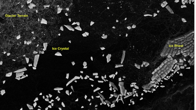
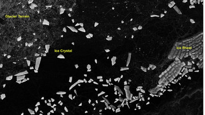
BENGALURU: Isro has made public the first batch of S-Band radar data from the Nasa-Isro Synthetic Aperture Radar (SAR) or Nisar mission, releasing it through Bhoonidhi, the agency’s earth observation data portal.The agency also shared sample images from Tamil Nadu (Nagapattinam), Antarctica, Assam (Brahmaputra basin), Idaho, Greenland and Indonesia showing the radar’s range of applications, from tracking coastal wetlands to mapping irrigation patterns and ice movement, underlining the mission’s relevance to both scientific research and everyday resource management, from coastal planning to precision farming and disaster monitoring.Nisar is a joint mission between Nasa and Isro, and is the first spaceborne radar to carry two frequency bands, L-band and S-band, on a single satellite. It uses a 12-metre reflector antenna and a scanning technique called SweepSAR, which lets it capture a wide strip of the Earth’s surface, about 240 km across, in high resolution without sacrificing coverage.Orbiting the Earth at 747km, the satellite revisits the same spot every 12 days, building up a steady stream of images useful for tracking floods, glaciers, farmland and other fast-changing features, regardless of weather or daylight.Isro said the mission is now in its science phase, gathering data from locations around the world as per its observation plan. The S-band data is received at Isro’s ground stations and processed at the Integrated Multi-Mission Ground Segment for Earth Observation Satellites in Shadnagar, run by the National Remote Sensing Centre. A nationwide network of ground-based reflectors is being used to check the accuracy of the data, alongside other reference targets chosen for specific scientific purposes.“…All data gathered from Cycle 25 onwards, which began on July 8, 2026, is now available for download as soon as it is processed. Older data, collected before Cycle 25, will be reprocessed in stages and added to the archive over time,” Isro said.The release includes several categories of processed imagery, ranging from raw radar scans to geocoded and interferometric products that can detect subtle shifts in the Earth’s surface, useful for monitoring subsidence, landslides and glacier movement.Users can search, view and download the data on Bhoonidhi after registering, using filters such as location, date and product type. Isro has also added two tools on the portal: one that converts the radar files into more widely used formats such as GeoTIFF, and another, built for QGIS software, that helps researchers analyse the data further.Isro noted that some scenes may show faint striping over featureless areas such as deserts and oceans, and occasional interference from radio signals, adding that both issues would be addressed in future updates as calibration improves.Launched on July 30, 2025, Nisar, had beamed back its first images of Earth in Sept last year, Nasa had announced, adding that the spacecraft was to begin its full operations later that year.