
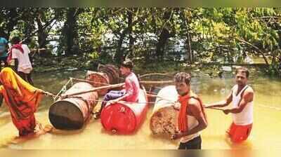
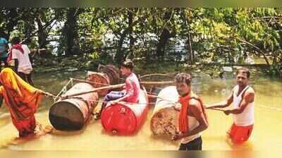
Patna: This year, Bihar witnessed three spells of floods. The first two were brief, occurring in mid-July and the last week of Aug. The comparatively longer third spell began in Sept and lasted much longer.The manner in which the floods struck the state this year seemed like a slowly unfolding tragedy with unforeseen natural forces playing a key role in turning it into a disaster. The situation began to recede visibly only over the past week.The rivers whose floodwaters affected people during the three spells were Kosi and Gandak in the first two. The third spell was mainly the result of the combined effect of the swollen Ganga, Sone and Punpun, besides smaller rivers such as Dardha.The third spell triggered widespread concern in and around Patna and elsewhere in the state, while the water resources department (WRD) and disaster management department (DMD) outlined the scale of the floods.The highest flood level (HFL) of the Ganga, recorded at 50.52 metres at Gandhi Ghat in Patna in 2016, was crossed when the river rose to 50.58 metres. HFL marks were also crossed at Pandarak and Hathidah in Patna district and at Sultanganj in Bhagalpur, where the previous record was set in 2021. The river flowed above the danger mark along its entire 515-km stretch in Bihar, ranging from 90 cm to more than 2 metres.By Aug, the floods had affected more than 10 lakh people in 54 blocks across 12 districts. By Sept 13, the DMD said 48.70 lakh people had been affected in 575 village panchayats across 88 blocks in 15 districts.DISTINCTIVE MARKSThe most striking feature of this year’s floods was the way they defied the stereotypical pattern associated with Bihar floods. Traditionally, floods have been linked to heavy rainfall in Nepal and Bihar and have mainly affected the north Bihar plains with comparatively less impact on districts south of the Ganga.Delayed monsoon arrival, mostly around the third week of June, has become the norm over the past few decades. This has largely been explained as an aftereffect of global warming and climate change. The monsoon months are increasingly marked by extreme heat, erratic rainfall, strong winds, lightning and thunder, which separately claim many lives.This year’s floods had three distinguishing features. First, the state experienced long dry spells marked by scorching sun and strong winds with only occasional rain, mainly in parts of north Bihar. This had raised fears of a return to severe drought conditions.Second, Bihar suffered a rainfall shortfall during the monsoon months, initially suggesting the quantum of rain would not be enough to trigger floods. Third, deaths caused by lightning and thunder had become frequent, prompting the Bihar State Disaster Management Authority (BSDMA) to issue warnings.In May, the Indian Meteorological Department (IMD) had forecast below-normal rainfall in July, normal rainfall in Aug and below-normal rainfall in Sept. The DMD said rainfall was 36% below normal in June, 33% below normal in July and 29% below normal in Aug, while there was 13% excess rainfall till Sept 13. Overall, rainfall remained 27% below normal from June 1 to Sept 13.DROUGHT SIGNSFor nearly two months, from mid-June to mid-Aug, people had begun to believe Bihar would experience neither sufficient rain nor floods. Farmers started using electricity from agriculture feeders to run pump sets and irrigate small plots for raising paddy nurseries needed for transplantation. Using diesel-powered pumps increased their input costs.They wanted rain, not extensive floods that would inundate cropped land and damage homes and property. The rivers originating in Nepal and flowing through Bihar remained calm, while Nepal’s terrain also appeared stable.Bihar has 38 districts, of which 28 are flood-prone, including 15 in the north Bihar plains designated as the most flood-prone. The south Bihar districts are designated as drought-prone. The state govt therefore remains prepared every year with standing plans for rescue and relief operations under the standard operating procedure (SOP), along with contingency plans for floods in north Bihar and drought conditions in south Bihar.In the last week of Aug, it was as if the elements had decided to hit Tibet, Nepal and Bihar. On August 26 at 8.30 am, the glacial lake on the Tibet-Nepal border in China collapsed. A huge mix of water, silt, debris and sewer surged through the valleys of the Himalayas in Nepal, raising fears of a major deluge in Bihar’s Gandak basin districts.The surge was expected to reach the Valmikinagar barrage on the Gandak in West Champaran in four to six hours. During this period, CM Samrat Choudhary and WRD minister Vijay Kumar Choudhary began emergency measures and visited the barrage site. The CM set up a high-level monitoring committee headed by chief secretary Pratyaya Amrit.All 36 gates of the barrage were opened to discharge water. DMs of the basin districts asked people living in the Gandak floodplains to remain on high alert and be ready to evacuate if necessary. Information was conveyed through ‘miking’ in the blocks and panchayats concerned. People were asked to ignore rumours and rely only on govt information.However, to everyone’s relief, the highest discharge level reached only 1.50 lakh cusecs by 11pm that night. The Gandak remained largely calm, except in its lower reaches. “The threat, if any, was averted, by opening the barrage gates in advance. Gandak along its downstream was not swollen, and therefore, easily absorbed the onrush of water,” a senior DMD official said.Meanwhile, heavy rain in Nepal increased the discharge at the Birpur barrage on the Kosi, whose 56 gates were opened. CM Samrat Choudhary and Vijay Kumar Choudhary also conducted aerial surveys of flood-affected areas in the Gandak basin. By Aug 29, the situation appeared to have returned to normal.FURIOUS RIVERSTwenty-five centuries ago, Lord Buddha warned the king and people of ancient Patliputra, modern Patna, of the dangers posed by “flood, fire and internal rebellion”.Fifty-one years ago, Patna was submerged by the waters of the Sone after 14.48 lakh cusecs of water, against the design discharge of 14.58 lakh cusecs, was released through the Indrapuri barrage on August 23, 1975. Barring a few upland localities, the entire city faced the deluge.Over the following two decades, a flood protection wall was constructed along the Ganga, along with protection embankments on the city’s southern outskirts. Still, Patna remained vulnerable with the Ganga to its north, the Sone to its south-west and the Punpun to its south-east.From the closing days of Aug this year, their catchment areas in Uttar Pradesh, Madhya Pradesh and Jharkhand, as well as Bihar, began receiving heavy rain. During the first week of September, Bihar received 79 mm of rainfall, 31% above normal. All 69 gates of the Indrapuri barrage were opened.On the night of Sept 1, the barrage discharge suddenly rose to 5.54 lakh cusecs and then to 5.63 lakh cusecs the following day. Three days later, the Ganga crossed its 10-year-old HFL of 50.52 metres at Gandhi Ghat and eventually touched 50.58 metres before beginning to recede.Had the Patna flood protection wall along the Ganga up to Danapur, the southern protection embankment and the city’s network of roads not existed, the city would have faced the deluge.“This year’s floods are different. It has been caused by the unprecedented flow of water through the river Ganga and all other rivers that fall into it,” WRD minister Vijay Kumar Choudhary told reporters on Sept 7.